
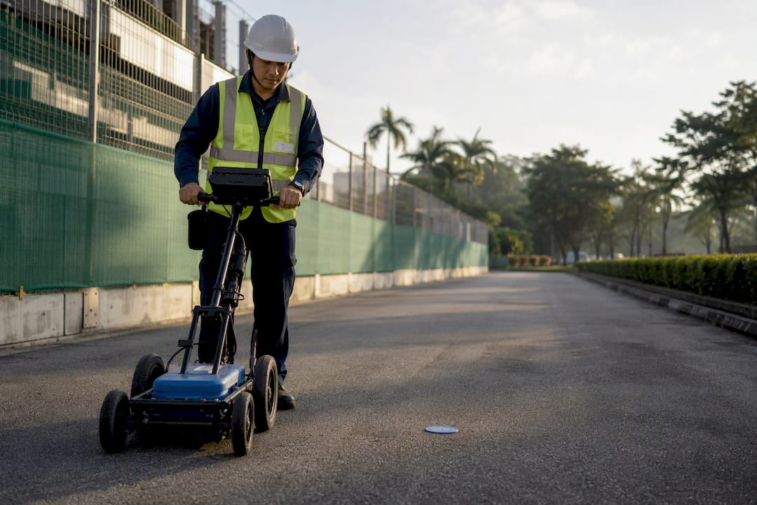
Subsurface utility mapping in Singapore is the standards-compliant process of locating, verifying and delivering georeferenced utility records for planning, safety and statutory submissions. Projects should begin by commissioning a Registered Surveyor-led survey and, where telecommunications or other critical services run nearby, engaging a licensed cable detection worker and scheduling trial holes. Deliverables typically flow to SLA, LTA, IMDA and SCDF in prescribed formats and coordinate systems.
TL;DR:
- Precise trial trenching is essential at critical crossings because geophysical surveys cannot definitively confirm utility positions or depths.
- Singapore standards require accuracy levels of approximately ±100mm for new utilities, referencing SVY21 coordinates and SHD datum for all submissions.
- Combining detection methods like GPR and electromagnetic locating with physical verification reduces the risk of undetected or mislocated underground services.
- Utility mapping outputs are increasingly integrated into BIM models to facilitate digital coordination and clash detection before construction.
- Selecting a provider depends on credentials and deliverable quality, with red flags including refusal to perform trial holes or incomplete compliance documentation.
Table of Contents
- What subsurface utility mapping covers and when to commission it
- Detection technologies: what works, what does not, and how to combine them
- Singapore standards and statutory requirements for accuracy and data formats
- Typical workflow and what a compliant deliverable package looks like
- Choosing a utility mapping provider: procurement checklist and red flags
- How Aman Engineering Consultancy supports statutory-compliant utility mapping and digital handover
- A short industry perspective on the path to a reliable digital underground
- How Aman Engineering can help with statutory-compliant handovers
- Sources
- FAQ
What subsurface utility mapping covers and when to commission it
Utility mapping serves four recurring functions on Singapore projects: design clash detection between proposed structures and existing services, safe excavation planning, as-built record creation, and long-term asset management for facility owners. Each function demands a different level of precision, but all rely on the same underlying survey discipline.
Engagement should occur at four project stages. At schematic design, a desktop review and preliminary detection survey flag major conflicts before layouts are locked. At detailed design, a full georeferenced survey confirms clearances for foundations, piling and services routing. Before any excavation, verification through trial holes confirms positions that detection alone cannot guarantee. At handover, an as-built package closes the loop for the facility owner and relevant authorities.

Mapping outputs increasingly feed directly into BIM models and multi-agency digital consultation platforms rather than sitting as standalone drawings. URA’s enhanced site investigation guidance treats utility data as part of a lifecycle process under INPAC, encouraging early digital coordination between agencies to reduce clashes before construction starts.
Detection technologies: what works, what does not, and how to combine them
No single method locates every buried service reliably, which is why Singapore practice combines geophysical detection with physical verification.
- Ground-penetrating radar (GPR) images layered subsurface conditions and detects non-conductive utilities such as PVC and concrete pipes, though performance degrades in dense clay or highly saturated soils and at greater depths.
- Electromagnetic locating and active tracing works well for metallic pipes and cables or any conduit fitted with a tracer wire, but it cannot find non-metallic ducts without one.
- CCTV and duct inspection confirms the condition and routing of enclosed assets such as sewer lines and empty ducts, where surface geophysics offers no visibility.
- 3D reality capture and laser scanning ties above-ground features, manholes and tie-in points to the same coordinate framework as the buried assets.
Trial trenching remains the only conclusive method for positively confirming a utility’s position, depth and material, particularly in Singapore’s dense urban corridors where multiple services often run within the same narrow reserve, making property condition report best practices for landlords a useful cross-industry reference for data quality and reporting practices. Geophysics narrows the search area; trial holes close the gap between a probable location and a confirmed one.
Pro Tip: Budget for trial holes at every crossing point identified by geophysics, not just the ones flagged as high-risk. Undocumented legacy lines rarely show up until the excavator finds them.
Singapore standards and statutory requirements for accuracy and data formats
Professionals delivering utility surveys in Singapore work against a defined set of accuracy tiers, coordinate systems and statutory review steps rather than informal best-effort practice.
- Quality levels and equipment. The SLA Standard and Specifications for Utility Survey defines quality levels for as-built surveys, with Quality 1 requiring positional accuracy of approximately ±100mm horizontal and vertical for new utility lines. Meeting this typically calls for RTK GNSS, a total station or 3D laser scanning, depending on site conditions.
- Coordinate systems and datums. Submissions to Singapore authorities must reference the SVY21 coordinate system and Singapore Height Datum (SHD). URA’s geo-referencing guidance applies this requirement to BIM submissions specifically, enabling automated cross-checks against other agency datasets.
- IMDA telecommunications proximity rules. Where earthworks approach telecom infrastructure, IMDA’s earthworks requirements direct contractors to obtain service layout plans, engage a licensed cable detection worker, submit a notice of commencement, and conduct trial holes with joint inspections before digging.
- LTA and SCDF submission specifications. The LTA GIS Data Hub specification prescribes required layers and SVY21 coordinates for street work submissions. For petroleum and flammable material pipelines, SCDF’s circular on utility survey standards requires Quality 1 accuracy for new lines and as-built plans delivered in .shp, .dwg or .dgn formats.
Typical workflow and what a compliant deliverable package looks like
A standard engagement moves through desk research on existing records, a field detection survey, positioning against SVY21 and SHD, physical verification at critical crossings, post-processing, and finally a Geo-CUP or as-built deliverable package suited to authority submission.
- Georeferenced drawings and attribute tables identifying utility type, material, depth and ownership.
- Point clouds or ground point cloud (GPC) datasets from laser scanning where reality capture was used.
- Detection and trial-hole verification reports documenting method and confidence per crossing.
- Registered Surveyor certification confirming the survey meets the declared Quality level.
- Digital exports in .shp, .dwg or .dgn, plus BIM-compatible files referenced to SVY21 for design integration.
Accuracy is reported against the SLA Quality level framework rather than a single blanket tolerance, so acceptance evidence should specify which Quality label applies to each utility segment and how it was verified. Turnaround and cost move with site congestion, the number of trial holes required, and whether telecom proximity triggers the full IMDA process described above.
Choosing a utility mapping provider: procurement checklist and red flags
Selecting a provider comes down to credentials, deliverable clarity and a demonstrated trial-hole discipline rather than price alone.
- Confirm credentials. Require Registered Surveyor sign-off on all as-built outputs, a licensed cable detection worker where IMDA proximity rules apply, and PE endorsement where the submission calls for it.
- Specify the deliverable checklist in the contract. State the coordinate system, datum, file formats, metadata standard, Quality level labels per utility, and a QA log before work starts.
- Ask direct bidder questions. Request sample deliverables, calibration records for detection equipment, a proposed trial-hole plan, and a description of the internal QA process.
- Watch for red flags. Refusal to perform trial holes, files delivered without coordinate referencing, and the absence of a Registered Surveyor in the chain are grounds to reject a bid outright.
Pro Tip: Ask for one worked sample deliverable before award, not after. A provider unwilling to show a formatted .dwg or .shp export with attribute tables rarely produces one on the actual project.
How Aman Engineering Consultancy supports statutory-compliant utility mapping and digital handover
Aman Engineering Consultancy works across the statutory chain associated with utility mapping, including authority approvals, PE endorsements and 3D BIM modeling for design integration. For projects needing utility conditions assessed against planned works, the firm’s impact assessment service evaluates site conditions before excavation or foundation work begins.
Survey deliverables can be integrated into authority submissions and BIM workflows through a single-point statutory coordination model, aiming to reduce the number of separate consultants a client needs to manage across SVY21-referenced drawings, PE certification and agency review. This coordination role sits alongside the broader statutory submission and inspection practice across structural, facade, fire safety and M&E disciplines.

A short industry perspective on the path to a reliable digital underground
The shift toward treating utility data as a managed, reusable asset rather than a one-off deliverable is overdue. Research into Singapore’s digital underground has tested mobile GPR platforms alongside reality capture, pointing toward a future where a consolidated map replaces fragmented, project-specific surveys. Consultants and owners should plan outputs for interoperability from the start: consistent metadata, declared Quality levels, and formats that survive the handover from one project team to the next. A survey that cannot be reused on the next project down the same street has already lost most of its value.
— Aman
How Aman Engineering can help with statutory-compliant handovers
Coordinating a utility survey with the statutory approvals it eventually feeds into is where most delays actually happen, not in the fieldwork itself. Aman Engineering Consultancy acts as a point of contact for coordination, pairing survey and impact assessment findings with the PE endorsements and authority approvals a project requires to proceed.

Readers evaluating a project that touches existing underground services can start with:
- Authority Approvals for statutory submissions, PE endorsements and PSI/PFI coordination.
- 3D BIM for integrating survey data into design models referenced to SVY21.
Projects ready to move forward can Amanengineering to confirm which statutory steps apply before fieldwork begins.
Sources
- Enhanced site investigation / INPAC — URA
- GIS Data Hub data collection specification v3.3 — LTA
- Requirements to be complied with by earthworks contractors — IMDA
- Implementation of standard and specifications for utility survey for P&FM pipelines — SCDF
FAQ
What accuracy level does Singapore require for new utility lines?
New utility lines are generally expected to meet Quality 1 accuracy under the SLA Standard and Specifications for Utility Survey, which sets a positional tolerance of approximately ±100mm horizontal and vertical. Contracts should state this Quality level explicitly alongside the coordinate system used for the submission.
Why does Singapore require trial holes even after a detection survey?
Geophysical detection methods like GPR and electromagnetic locating narrow the probable location of a utility but cannot always confirm depth, material or exact position with certainty. IMDA’s earthworks requirements require trial holes and joint inspections near telecom infrastructure specifically because undocumented or untraceable cables can otherwise go undetected.
Which coordinate system do Singapore authorities require for utility submissions?
Submissions must reference the SVY21 coordinate system and the Singapore Height Datum (SHD), as set out in LTA’s GIS Data Hub specification and URA’s geo-referencing guidance. Using a different local working coordinate system without conversion is a common cause of submission rejection.
What file formats do authorities accept for as-built utility data?
Common formats include .shp, .dwg and .dgn, as specified in SCDF’s pipeline utility survey circular for pipeline as-built submissions. BIM-integrated projects also require exports compatible with the model referenced to SVY21.
Does Aman Engineering Consultancy provide utility mapping directly?
Aman Engineering Consultancy focuses on statutory coordination, impact assessment and BIM integration around utility data rather than performing the geophysical detection survey itself. The firm’s impact assessment service and authority approvals practice support projects in aligning survey outputs with PE endorsement and agency submission requirements.